Log Jam turns a folder of raster-era LAS chaos into a clean, color-shaded cross section you can pick tops on in minutes. Ingest, QC, correlate, export. No project database to babysit, no seat install marathon.
Log Jam is a lightweight well log correlation app. Point it at a folder of LAS files and it ingests, depth-checks, and QCs every well automatically. Load a spreadsheet of surface and bottom-hole locations in whatever coordinate system the landman handed you, footages included, and your wells land on the map.
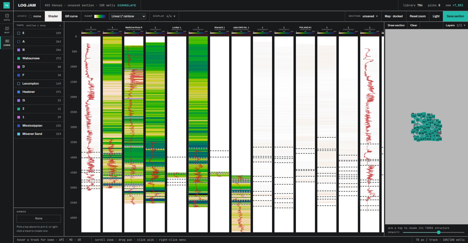
From there, draw a section on the map and start picking. Logs render as color-shaded gamma-ray fills built on perceptually uniform palettes, so subtle log character stands out and tops jump off the screen. Horizontal wells are flagged so picks stay on the vertical wellbore, and armed tops shade in true vertical depth subsea as you work, structure while you pick.
When you are done, export your tops with your interpreter code, ready for mapping software or the next person on the project.
Drop in a whole folder of LAS. Every well is depth-checked and quality-controlled on the way in, with a per-well QC report so bad curves never sneak into a section.
Lat-long or state plane footages, NAD27 or NAD83, surface and bottom-hole locations in one spreadsheet. Log Jam reads the columns, converts the datum, and maps the wells.
Gamma-ray shader fills on five perceptually uniform palettes, with resistivity overlay, or flip to classic curves. Log character reads at a glance across the whole section.
Thousands of wells in a project, correlation sections a hundred wells wide, drawn and repicked without breaking stride.
Armed tops shade in TVD subsea as you pick, so structural sense builds with every well. Suspected horizontals are flagged in the data table and dimmed below the heel in correlation view.
One click exports every pick with well ID, depth, elevation reference, and your interpreter code, ready for your mapping package.
Sixty-six seconds of correlation, ingest, and QC on a public-record Kansas dataset. No narration needed.
Ten minutes, end to end: ingest a folder of LAS, load footage coordinates, build a section, and pick tops.
Poke at a live copy loaded with the Kansas demo project, or grab the dataset and run the full workflow on your own machine.
A hosted instance of Log Jam with the 700-well Kansas project already ingested. Draw a section, arm a top, and start picking. Nothing to install.
Open the demo107 LAS files, a footage coordinates spreadsheet, and directional surveys, all public-record wells from the Kansas Geological Survey. About 54 MB zipped.
Get the dataset